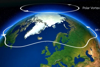

A touch of snow, a sudden stratospheric warming over the Arctic and a record-breaking El Niño taking place in the Pacific Ocean means there’s a meteorological melting pot of influences on the UK’s weather in the coming months, but just how could this affect the weather for the winter ahead?
“What will this winter be like?” isn’t a new question for us here at the Met Office. But asking for a look at the potential weather for a whole season rarely gives a simple answer. Here, we break down how seasonal outlooks differ from day-to-day forecasts, the different factors at play in the months ahead and where probabilities are shifting in current long-range modelling.
A season’s weather is rarely consistent
First, it’s important to understand the subtleties of seasonal weather and why it requires more nuance than might typically be expected in a weather headline.
When assessing the weather for a 3-month period, probabilities of different conditions come into play. While the day-to-day forecast people see is a definitive look ahead at the next few days of weather, for seasonal timescales it involves running weather models forward lots of times over a long period and then assessing what all of this data tells us about the probability of weather conditions over the season as a whole.
This means dealing with probabilities of whether a 3-month period will be above average, below average or near average for a range of broad meteorological metrics such as temperature and rainfall.
Probabilities for a whole season, however, don’t capture the day-to-day variations in weather. And probabilities are just that – a look at the chances. It doesn’t mean that the ‘less likely’ scenario won’t come off.
Probability-based outlooks of this nature are vital for contingency planners as input to long-term plans, but they’re not much use as a forecast for the day-to-day weather people might experience through the season.
Looking ahead to winter weather
The record-breaking El Niño in the Pacific Ocean has long been seen by meteorologists as being potentially influential over the UK’s weather over the coming winter months (December, January and February), but it’s not the only factor at play.
Strong El Niños can favour a mild and wet late autumn and early winter period, followed by a colder and drier period later in winter. Again, these are shifts in probabilities rather than a definitive forecast, with some El Niño winters having different patterns of UK weather as a result of factors unrelated to El Niño.
Met Office Scientific Lead Jeff Knight, who contributes to seasonal forecasts, explained how the probabilities are shaping up. He said: “We have an historic El Niño that is very likely to influence the outlook for the winter. In recent model output, we are seeing elevated chances of weather patterns similar to those linked to El Niño events in past winters.”
“This pattern is called the negative phase of the North Atlantic Oscillation (NAO). A negative NAO corresponds to higher-than-usual pressure across a broad portion of the North Atlantic north of the UK and lower-than-usual pressure further south. In UK latitudes in winter, a negative NAO results in the reduction of the mild, damp westerly winds that we usually receive. Consequently, a negative NAO winter is more likely to be colder and drier than usual.”
The graphic below shows predictions of the phase of the NAO from current Met Office modelling. The shading represents the range of outcomes from running the model many times, with progressively redder shading highlighting the more likely outcomes. The average of all predictions is shown by the solid line. While positive NAO values are not ruled out in any of the winter months (December, January, February), more of the likelihood is clustered around quite strongly negative values.
According to the graphic, each winter month has a 70% chance or more of having negative NAO. Confidence in the model outputs shown for spring (March and April) is low at this range.

Jeff added: “Whilst negative NAO is by no means a certainty, its increased likelihood indicates that the models as they currently stand are likely to favour colder- and drier-than-average conditions this winter.”
When will we know more about prospects for UK winter?
The Met Office produces a 3-month ahead Outlook for use by contingency planners. In the lead up to and during this winter, Outlooks will give an overview of possible conditions for the UK. This will take account of the latest modelling available at the time and careful assessment of the state of the climate around the globe and its potential influence on the UK.
Variability of weather patterns
The probabilities of different conditions will continue to shift as the season progresses and new forecast information becomes available. Day-to-day fluctuations in the UK’s weather will continue to be communicated through the Met Office’s forecasting and, when action is required for severe weather, through the National Severe Weather Warning Service.
As we move through winter, shorter-range forecasts will increasingly provide detail on whether any particularly cold spell is likely, how severe it could be and which parts of the UK could be affected.
An increased chance of cold weather through the season doesn’t mean there will be snow, as much as some online headlines might like there to be. Snow itself can only be forecast at much shorter ranges, with a number of factors needing to align for a significant snow event.
The best way of staying on top of impactful winter weather is to sign up to alerts for weather warnings, while news releases and blogs can also keep you up to date with the very latest from the Met Office’s meteorologists.
You can get advice for preparing for winter weather through WeatherReady.
You can find the latest forecast on our website, on YouTube, by following us on X and Facebook, as well as on our mobile app which is available for iPhone from the App store and for Android from the Google Play store.